MISO investigates how the Southern Ocean is responding to climate change
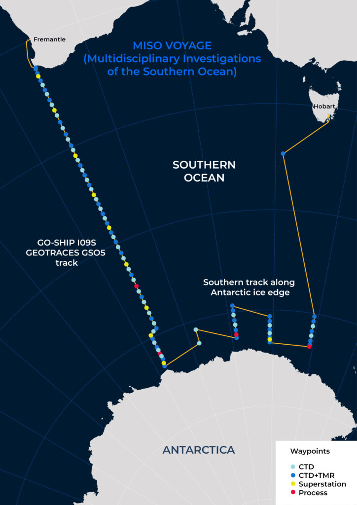
The recently returned MISO voyage (Multidisciplinary Investigations of the Southern Ocean) was a 2-month journey along the edge of Antarctica on the RV Investigator. The scientists on-board gathered one of the most comprehensive datasets collected on the Southern Ocean. This included measurements of iron and other trace elements essential for marine life.
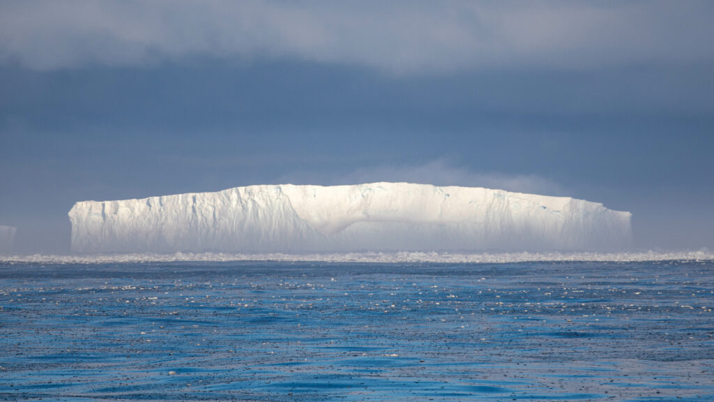
Building a better understanding of this part of the world is essential to anticipate future climate change and its impacts. The ocean currently absorbs more than 90 per cent of the excess heat and carbon dioxide in the atmosphere—and the Southern Ocean stores more than any other part of the ocean, significantly slowing the pace of climate change.
The interview below is with ACEAS Antarctic Paleoceanographer Dr Tom Williams, who was aboard the voyage.
What were you working on (on the MISO voyage)?
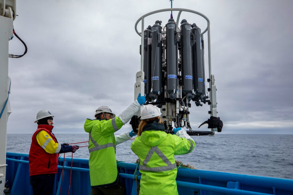
I was part of a team working to characterise the chemistry of the water column around East Antarctica. This chemistry is closely linked to biology, with things like the concentration of iron being an important limiting factor on how much plankton can grow in the otherwise fertile oceans in this region.
We were also measuring a whole host of other elements, which can tell us about a range of different biological and oceanographic processes.
As well as measuring various elements dissolved in the seawater itself, we were lowering instruments into the deep ocean to collect floating particles from up to 8 different depths. This data will help us understand how biological particles move through the water column, and trace potential sources of food organisms living in the deeper ocean, as well as track how much biological carbon is moved from the surface ocean into its deep interior.
What do you hope to achieve?
One of the main objectives of the voyage was to take measurements along a south-to-north transect, running in a straight line from Antarctica all the way up to just offshore Perth, which was sampled previously. The aim of this is to get baseline measurements of the ocean from the same place, roughly every 10 years or so, kind of like a health check-up for the ocean. This line was measured three times in the past, but this time around our team is including a whole bunch of new measurements for the very first time, massively expanding the type of data compared to what has been collected previously. These data will provide a baseline to compare measurements taken in the future and help trace how the area responds to future climate change.
Because nobody has done kind of work here before, it’s especially exciting to see what we find!
As well as this line, we took the opportunity to sample along the Antarctic margin from ~150°E (roughly due south of Tasmania) to 113°E (roughly due south of Perth). We managed to get into an area not usually accessible due to sea ice, to take measurements right along the Antarctic coastline, which was really exciting from a scientific perspective, but also as a tourist!
How will this work evolve now?
Unlike a lot of other data collected on the voyage, we couldn’t make actual measurements on board the ship. Instead, we collected literally thousands of water samples—everything from filling small 60 ml bottles up to 10 litre sized jerry cans. These samples will be measured in various labs across Australia (and internationally) using sensitive equipment that we simply can’t take with us on the ship.
The MISO voyage will help decision-makers in government, industry and the community make informed decisions based on the best possible climate science.
Read all about the voyage at the Australian Antarctic Program Partnership (AAPP) blog: https://aappartnership.org.au/miso/