Satellite observing breakthrough for monitoring the movement of Antarctic dense water
Ocean modelling researchers have discovered a reliable and long-term new method to capture the formation and export of dense water around the Antarctic coast.
Dense water is formed as sea ice freezes, producing vast amounts of salty water that sinks. Being able to monitor the dense waters formed on the continental shelf – and their overflow down the slope to deeper open waters – is critically important, because their movement into the abyss ventilates the deep ocean with oxygen.
The process is vital to driving the global overturning circulation or ocean conveyer belt, which helps control the world’s climate through the storing of heat and carbon dioxide, and fuels much of the world’s marine productivity by bringing nutrients to the surface.
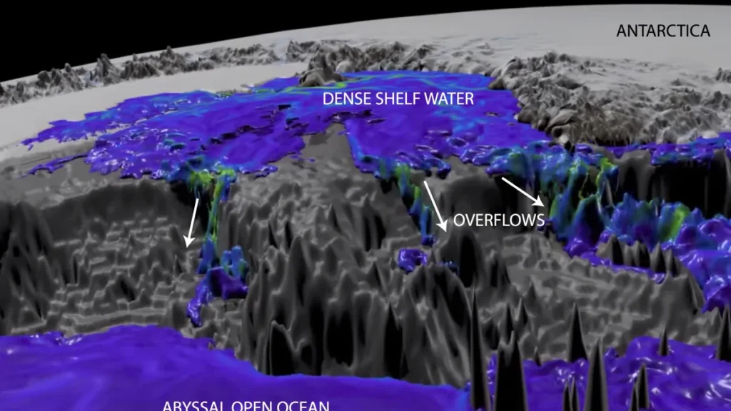
In the new study published in Nature Communications: Earth and Environment, researchers show these dense water overflows can be monitored from space, incorporating year-round sea surface height observations from satellites.
Lead author Dr Matthis Auger from the ARC Australian Centre for Excellence in Antarctic Science (ACEAS) and the Institute of Marine and Antarctic Studies at the University of Tasmania, says the discovery is significant.
“This breakthrough will allow for autonomous and long-term observation of these currents,” he says.
“This is vital for understanding the earth’s response to climate change.”
The ability to develop this capability for future research comes at a critical time, when the lower overturning cell is believed to be already undergoing a drastic slowdown.
And a projected future increase in glacial melt and surface warming is likely to lead to a further decline in dense water formation.
An exciting new research frontier
Until now, accurately observing variations and change in the transport of dense waters from the Antarctic continental shelf has proven extremely challenging for researchers.
In-situ observations have been sparse and expensive, relying on carbon-emitting ship-based methods or models that have been unable to capture a complete picture of the intricacies at play, including cascades through narrow overflow troughs.
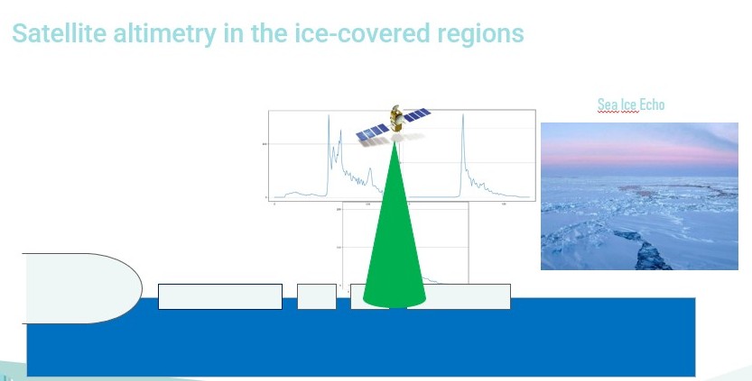
The method relied on in the study uses satellite observations that capture varied and more frequent sea surface height signatures of the dense waters as they cross the continental shelf break in Antarctica’s Ross Sea.
It can also reveal ocean dynamics underneath sea ice, such as eddies and large-scale ocean currents.
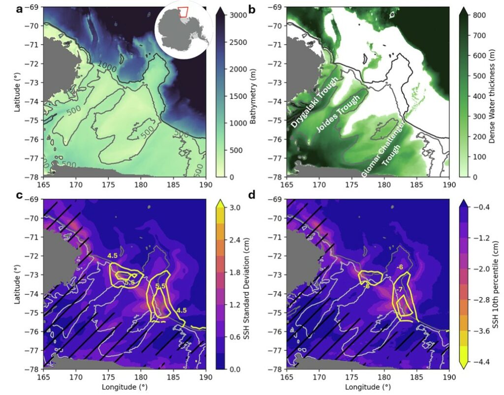
observations and the PanAntarctic model simulation.
High-resolution simulations allow researchers to find a reliable proxy, that when applied to the existing satellite record, reveals results that align with multi-year changes in dense water properties captured in hydrographic surveys.
Dr Auger says the discovery could greatly enhance future research efforts.
“These are crucial advantages as we seek to monitor a rapidly changing climate system,” he says.
“The intensity of those deep Antarctic currents is one of the main uncertainties in global climate projections, and the ability to track their changes from space will be a vital tool for refining our future climate predictions as we seek strategies for adaptation.”
PAPER
Matthis Auger, Paul Spence, Adele K. Morrison, Alberto Naveira Garabato and Alessandro Silvano. (2025) ‘The variability of Antarctic dense water overflows can be observed from space’ Nature communications: earth and environment. DOI: 10.1038/s43247-025-02210-7
—
Explainer: how does Antarctic dense water move?
Dense water forms in coastal polynyas, flooding the bottom layer of the Antarctic continental shelf. It overflows at the shelf break, via troughs scoured by glaciers. From there, it travels down the steep continental slope as a gravity current, mixing with other masses as it turns into Antarctic Bottom Water. This results in the abyssal overturning circulation, ventilating the deepest layers of the global ocean and allowing the sequestration of heat and carbon from the atmosphere in a changing climate.
Satellite altimetry
A technique that uses radar signals to measure the height of the Earth’s surface – in particular the sea surface – by measuring the time it takes for radar pulses to travel from a satellite to the surface and back.
